Tuesday, May 30, 2017

End of the Trail


"Our journey through the desert was from Monday, three o'clock in the afternoon, until Thursday morning at sunrise...The weary journey last night...will never be erased from my memory.  Just at dawn, in the distance, we had a glimpse of Truckee River, and with it the feeling: Saved at Last!  Poor cattle; they kept on mooing, even when they stood knee deep in water.  The long dreaded desert has been crossed, and we are all safe and well."  
Sallie Hester, September 6, 1849  

 
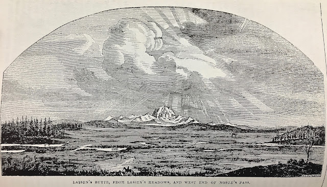
Close to the end of the trail for my ancestors, Mike & Sarah Ann Robinson Gray


We Are But Brief Visitors....

Why this quest to re-trace my ancestors' 1849 overland journey from Missouri to California?   Connection.  Connection with the land.  Connection through time.  Connection  in spite of time.   Connection  through DNA.  Connection to the unknown, unknowable, the unbounded.  

A panel at the National Historic Trails Interpretive Center in Casper, Wyoming says it well:


"...Gone for centuries now are the aboriginal people that hunted bison on the plains around you, and trappers that ventured here seeking beaver, mink, and otter.  Gone are the pioneers that struggled to keep their footing as they forded the cold North Platte, and the first prospectors seeking fortune from the land itself.  Gone, but all shared the memory of this place.


Here you can be sure of some things, even though they left no mark on the land.  Here a child sat near a campfire and heard a wolf howling in the cool, damp air of an early summer night, as she wondered what "The Oregon" would be like.  From the ridge across the river an Arapaho warrior saw the first wagons crossing and rode away to share his discovery with the elders of his camp.


Beneath a slate grey sky blowing snow in October 1856, a party of the [Mormon] faithful buried their dead with what frozen strength they could muster.  In 1861 a Pony Express rider hurried his mount westward carrying President Abraham Lincoln's first inaugural address.  A month later, the Express relayed news of the start of the War Between the States to an anxious California.


Each of them saw much of what you see today during their fleeting visit to this bend in the river.


We are brief visitors ourselves, like the shadows of those who came before us, yet that does not diminish the importance of what occurred here.  We share their fears of the unknown path ahead, the tears and suffering, the laughter and hard work that accompany the growth of our nation.  Your presence here today affirms the worth of experiences by those long departed from this place."


This blog is dedicated to my ancestors who traversed this continent: Pleasant Gray who died of cholera near present day North Platte NE and Mike Gray & Sarah Anne Robinson Gray who made it to the promised land of California.       


  Mike Gray, who captained the Madison County California Mining Company 
wagon train scouting party at age 22
                          Sarah Anne Robinson Gray, who claimed that the journey mostly by horseback                                  at age 19 was one of the happiest  experiences of her life


Rocks collected from various known sites along the overland trail.
These will be placed on Mike and Sarah Anne Robinson Gray's graves in Colma, California

Red Star Shaman by Arthur Short Bull, Oglala Lakota Sioux artist, http://www.dawnhawk.org/index.html

First Encounters of the Close Kind: Phrynosoma cornutum


Among the many denizens of the Far West new to the emigrants were bison (not a buffalo),  pronghorn (not an antelope), prairie dogs, "grizzle baers" and a tiny creature called a "horned toad" or "horned frog" (actually a lizard, phrynosoma cornutum).  Some, especially children, thought it was an avatar of the devil.   

In actual fact, the reptile is a most charming creature.  My first and only encounter with one happened in 2010 while volunteering at Bryce Canyon National Park.  Scrabbling in the sand near our cabin, my new friend was searching for Harvester ants from a mound nearby.  Perfect in every respect, with tiny sawtooth ridges at his circumference, he had a little crown of horns at the back of his head.  These horns are, in actual fact, made of bone.

Horned lizard around our cabin, Bryce Canyon National Park, September 2010
The horned lizard is perfectly camouflaged.  While it can scurry around, it is generally slow moving and, if you are gentle, will sit quietly in your hand.  If frightened, the horned lizard has the alarming ability to squirt a stream of blood up to five feet from the corners of its eyes and mouth.  To boot, the blood is mixed with a foul tasting chemical.  A most effective defense against most predators.  The horned lizard is now a protected species, suffering from the pet trade, urban sprawl and pesticides designed to kill its primary food, Harvester ants.

While at Bryce, I found an almost perfect plastic replica of a horned lizard.  I named him "Hoodoo" after the odd totem pole-like rock spires in the park and other southwestern areas.  He sits on my car dashboard, beckoning me onward.  He was my protector and mascot on this overland trip.  Hoodoo -- as in Hoo-Doo-You-Luv.


"The curious may here [at the La Bonte river, near Horse Shoe Creek, Laramie mountains, Wyoming] look out for toads with horns."  J.E. Ware's Emigrant Guide to California, published 1848, p. 21

"There were many miles of weary travelling across deserts and alkali dust that would almost suffocate us, to say nothing of rattlesnakes and horned toads and other reptiles and biting insects."  Elizabeth Drusilla Robinson Smith, sister of my ancestor by marriage, Sarah Ann Robinson Gray, 1849

"Here  we found Horn-frogs....No grass or water during the morning drive.  Reached a branch of 'La Bonte.'"  J. Goldsborough Bruff, July 15, 1849  


Hutching's California Magazine, the first illustrated magazine that popularized the West ~1868


Monday, May 29, 2017

The Anatomy of Thirst 


Twenty-six miles southwest of Lovelock, Nevada, the Humboldt river vanishes into the earth.  From there, emigrants faced a 40-mile trek across an alkali desert, a journey of about 3-4 days.  It took me 40 minutes in an air-conditioned SUV, while eating a pint of organic blueberries....


Illustration by J. Goldsborough Bruff, emigrant, 1849

Symptoms of extreme thirst and dehydration:

Sunken eyes, pale flacid skin, dry heaves, spitting bile, painfully swollen tongue, kidney malfunction resulting in extreme burning in kidneys and urethra, brain rupture, hallucinations, death.

"The thermometer indicates 140....I look out over an arid, burning waste....the whole atmosphere glows like an oven."  Niles Searls, June 22, 1849

"Here I saw a number of ox teams of five or six pairs each, lying down in their yokes, -- some of them dead, some of them with their swollen tongues lying extended out into the dust, and moaning and groaning as pitifully as one of our own kind, -- unable to avoid the almost perpendicular rays of the sun now beating upon this spot with a fury almost indescribable."  Carlisle Abbott, 1850  

"The cattle and horses were so famished for water, that it was with great difficulty that we kept them from rushing into the boiling water...one ox belonging to another company got loose and went to a well to drink, slipped and fell and was scalded so badly that the hair all dropped off."  Elizabeth Drusilla Robinson Smith, 1849

"I wish California had sunk into the ocean before I had ever heard of it...that desert has played hell with us...Abandoned wagons, dead cattle, and articles of every description lay strewed along the road between that time and dark; that is, for the next 16 miles I counted 163 head of dead stock -- oxen, mules and horses -- 65 wagons, some of them entire, others more or less demolished, about 70 ox chains, yokes, harness, trunks, axes, and all minor things I did not count, and these only while riding along the road."  James Wilkins, September 9-12, 1849  

"As soon as an ox dies, he bloats as full as the skin will hold, and sometimes it bursts, and his legs stick straight out and he smells horrible....When they are nearly decayed there is frequently three or four bushels of maggots about the carcass."   William Swain, July 20, 1849

"For many weeks we had been accustomed to see property abandoned and animals dead or dying.  But those scenes were here doubled and trebled.  Horses, mules, and oxen, suffering from heat, thirst, and starvation, staggered along until they fell and died on every rod of the way.  Both sides of the road for miles were lined with dead animals and abandoned wagons...The owners had left everything, except what provisions they could carry on their backs, and hurried on to save themselves."  Margaret Frink, 1850


Sunday, May 28, 2017

Bad Water & Bugs....

The Humboldt is a muddy brown river about 290 miles long that flows west southwest across a good portion of Nevada.  It is the only natural transportation artery across the Great Basin. Then the water simply sinks into the ground and disappears about 12 miles west of Lovelock.  This left emigrants with a ~100-mile desert trek before facing the verticality of the eastern slopes of the Sierra Nevada.  

Today Interstate 80 closely parallels the emigrants' route along the Humboldt.  My one day trip from Twin Falls Idaho, to Elko and then Winnemucca in my trusty Toyota Highlander SUV is best described as a tedious ocean of sage brush.  On foot with no air conditioning that would be 18 days for the emigrants.  Their journey was further enhanced with foul water and clouds of insects:

"Today we bid a final adieux to the nauseating Mary River [later re-named the Humboldt by John C. Fremont in 1848].  Never again do I desire to see its poisoning waters, miserable sloughs, parched valleys and bare, painful looking mountains."  William Franklin, 1850

"The road to day has been very dusty and disagreeable -- the [Humboldt] river not far to the right all day.  The traveling on this river is anything but pleasant -- thick dust by day and mosquitos by night....Not a green thing can be seen ...but brown and rugged mountains is the constant scenery." Jotham Newton, 1853

By 6pm I reached Button Point, about 10 miles west of Winnemuccca, a natural spring area used as a camping spot by the pioneers.  It looks inviting enough:

Button Point Springs, just east of Winnemucca Nevada

I had stopped to clean my windshield. As Mike will attest, I hate doing this.  But, facing west into the sun, the bug splats had reduced my windshield visibility to nill.  How could there be so many insects fond of sagebrush?  When I stepped out of the car I was enveloped in gnats...

Bugs on my car windshield, Button Point, 10 miles east of Winnemucca
"Mosquitos were as thick as flakes in a snowstorm.  The poor horses whinnied all night, from their bites, and in the morning the blood was streaming down their sides."  Margaret Frink, July 11, 1850

"...a little water, not very good at that, and Musketoes in any quantity of all sizes, ages, from the size of a Gnat up to a Hummingbird, with their bills all freshly sharpened, and ravinous appetites."  John Wayman, June 27, 1852

Thursday, May 25, 2017

A Good Use of Public Funding?


Fossil Beds National Monument is a 5 star gem located just west of Kemmerer, Wyoming.  Worth the trip to see it alone.  Friendly, knowledgeable, professional staff.  A facility and landscaping that accentuate the beauty of the scenery.  Gorgeous, informative displays.  No fast food.  No billboards.  Nobody making a buck.  

Proof that America is already great.

Just a reminder.  It's a choice that "we the people" make -- and can un-make.


For comparison purposes, here is today's Niagara Falls which had the misfortune of being "discovered" before the National Park system was invented.  My opinion: the gorgeous falls are ruined, on both the American & Canadian sides, by towering, ugly hotels that just had to be built with a view of the falls.  At Bryce Canyon National Park, the decision was made to position the grand hotel away from the view.  It was controversial but wiser heads prevailed and today there is an amazing, unobstructed view of the rock spires which make the park so wondrous.

View of Niagara Falls, complete with hotel towers and power plant

This was our view upon arrival at Niagara Falls in 2014, complete with a 30 minute wait to park for $40


Big Hill


The truth is that the past fades quickly.  I find that my current self bears almost no physical, psychological or intellectual resemblance to the child I was over 60 years ago.  The same is true for the California-Oregon trail.  All things change.

So, it's a rare treat to see something that looks pretty much as it did 167 years ago, in 1849.  Even better, it happens to be one of the handful of spots that I can be pretty confident my gold rush ancestors actually had the misfortune to experience.  Several years later a detour around "Big Hill" was found.

In 1843 Theodore Talbot wrote that Big Hill "is the greatest impediment on the whole route from the United States to Fort Hall."  It wasn't so much the steep ascent but rather the long, torturous descent into Bear River Valley, some 40 miles west of present day Montpellier, Idaho:

"...at the summit we had to unhitch the teams and let the wagons down over a steep, smooth sliding rock by ropes wound around trees by the side of the road.  Some trees are nearly cut through by ropes."  Eliza Ann McAuley, July 15, 1852


Last resort: lowering wagons by means of ropes

"Superlatives are vain and language weak in an effort to describe the badness of this road; hilly, rocky, sideling, and precipitous.  We let the wagons down the rocks some sixty feet in one place; other places we kept the cattle on but attached ropes to ease the wagons down." John Edwin Banks, 1849
Another emigrant, James Wilkins, undertook the Overland trek in 1849 specifically to document the experience in writings and drawings.  Here is his illustration of Big Hill:


Big Hill by James Wilkins, 1849

Here it is today:
Big Hill, 2017


Wednesday, May 24, 2017

Continental Divide: South Pass & Pacific Springs


"Sometimes we felt a reverence for all this, especially when we came to the summit of the Rocky Mountains.  We were there on the Fourth of July and the climate celebrated it -- not with fireworks but with a storm right from the North Pole by way of Spitzbergen.  It cut like a knife, it seemed sleeted and was so bitter cold that we had to wrap ourselves in blankets to keep from freezing.  We could not have a fire so we had no hot coffee or tea to brave the climate, but we stopt long enough to inspect the spring right on the summit of the mountain which ebbs and flows like the ocean."

This is how Elizabeth Drusilla Robinson Smith, sister of my ancestor's wife, described their journey through South Pass and Pacific Springs, Wyoming.  Today, driving along Highway 28 at the top of the world, the scenery is sweeping -- as is the wind which practically ripped the car door from its hinge as I got out and which pushed me about as I attempted to photograph the sign at the Continental Divide, elevation 7,750'.  To the north in the snow covered Wind River range, I could see a roaring stampede of clouds and a dark curtain of rain racing towards me, towards South Pass and Pacific Springs, just as it did on the Fourth of July in 1849....

Incoming storm...


"We are now within a few miles of the summit of South Pass.  The Wind River mountains lay cold and silent off to our right.  The country appears like high rolling prairie." Franklin Starr, June 27, 1849

South Pass was the Way West.  The only way.  The only corridor through the Rockies between Atlantic and Pacific "without any toilsome ascents" as John C. Fremont described it.  No toil?  Hmmm...  On the other hand, the passageway is smooth enough:

South Pass, the Continental Divide


Emigrants were poignantly aware of the Continental Divide, both physically and emotionally.  

"After every shower [at South Pass] the little rivulets separate, some to flow into the Atlantic, the others into the Pacific."  Margaret Frink, June 24, 1850

"The ascent is so gradual that the culminating point is a matter of doubt....In a musing mood, I ascended  a high hill opposite our camp, to take a parting look at the Atlantic waters, which flowed towards all I hold most dear on earth."  Alonzo Delano, 1849

South Pass also marked other Divides.  Now the emigrants faced the the second half of their journey.  Gently rolling prairies and flowing rivers were no more.  The roughest travel --through mountains and alkali deserts and yet more mountains -- was yet to come.
Trash on the Trail 

Then...


"The abandonment and destruction of property here at Deer Creek [near Fort Laramie] is extraordinary: true, a great deal is heavy cumbrous, useless articles: a diving bell and all the apparatus, heavy anvils, iron and steel, forges, bellows, lead, &c.&c  and provisions: bacon in great piles, many chords of it -- good meat.  Bags of beans, salt, &c.&c. Trunks, chests, tools of every description, clothing, tents, tent poles, harness &c.&c. I took advantage of the piles of bacon here and had all mine trimmed of fat and the rusty exterior and the requisite amount of pounds replaced by choice cuts from abandoned piles.  Was told of a man here, who a few days ago offered a barrel of sugar for sale, for about treble its cost, price — and unable to obtain that, he poured Spirits of turpentine on it, and burned it up. The spirit of selfishness has been here beautifully developed —Discard effects generally rendered useless: — Camp utensils and vessels broken, kegs and buckets stove [in], trunks chopped with hatchets, & saws and other tools all broken." Joseph Goldsborough Bruff, July 17, 1849


"For many weeks we had been accustomed to see property abandoned and animals dead or dying.  But those scenes were doubled or trebled....Both sides of the road for miles were lined with dead animals and abandoned wagons.  Around them were strewed yokes, chains, harness, guns, tools, bedding, clothing, cooking utensils, and many other articles, in utter confusion. The owners had left everything, except what provisions they could carry on their backs, and hurried on to save themselves."  Margaret Frink, 185


Now....


Near Fort Laramie

Monday, May 22, 2017

Seeing the Elephant: Cholera, Graves & Wolves on the Platte River Road

"'Tis awful when you see an acquaintance at noon well and in the enjoyment of health and learn in the evening that he is a corpse."  Jon Nevin King, letter to his mother, June 16, 1850

Cholera, a disease which was endemic to the Indian subcontinent, found its escape route with the British tea trade in about 1817.  From England it spread to Europe and then hopped across the Atlantic Ocean to North America where it followed the Erie Canal, Cumberland Gap and other frontier trade routes.  By 1849 it was raging at the jumping off points for the Overland Trail and it followed the emigrants all the way out to California and Oregon.   

Cholera is a nasty disease.   Symptoms start without warning half a day to five days after ingestion of the bacteria.  The symptoms are simple:  diarrhea and vomiting of clear liquid -- 3 to 5 gallons of it. The results: sunken eyes, dry mouth, clammy skin, wrinkled hands and feet, labored breath, muscle cramping and weakness, seizures, coma and death.  A man can wake up feeling fine in the morning and be dead by night.  No wonder.

The disease is transmitted by contaminated food or water caused by poor sanitation.  By late May 1849, Fort Kearney, the first army emigrant aid post on the Platte River, reported that over 2,000 people and 10,000 cattle, mules and horses were passing each day.  The river, of course, was used by all for drinking, cooking, bathing, laundry and more.

On June 9 of that year, after a 3-day illness, my third great grandfather,  Captain Pleasant Gray, tough frontiersman that he was, "saw the elephant" (euphemism for experiencing hardship & death on the trail) in far western Nebraska.  How do I know this?  The diary keepers.

Since there was a paucity of road signs and an abundance of death, many diarists assiduously & worriedly recorded trailside graves.  Bernard Joseph Reid, Joseph Sedgley and J.G. Bruff all recorded my grandsire's grave as they passed it within days of each other on the well beaten trail.  Sedgley's account is the most detailed:

Tuesday, June 19.  Morning pleasant.  Left camp....we traveled over a fine road but found neither wood nor water.  We camped at six near the south fork of the Platte...we just escaped a heavy shower; lightning struck within a few feet of camp, tearing up the ground.  Passed the grave of Capt. C. of Texas [a mis-reading of the grave sign, "C." for "G."].

Wednesday, June 20.  Morning cloudy. Wolves are howling about our camp and some have ventured in.  We left camp at seven.  After going two miles we came to the ford of the south fork of the Platte [actually the Lower Crossing of the Platte near present day Hershey, Nebraska].  ....Mosquitoes numerous and annoying.


Lower Crossing, South Platte river near Hershey, Nebraska


Of course, most of the graves along the Overland Trail have long since disappeared, including Pleasant Gray's.  Nevertheless, I retrieved some stones near the Lower Ford of the Platte in Hershey and added them to my collection of trail rocks.  When I get home, I will put the stones on the grave of Pleasant Gray's son, Michael Gray, who made it to California and was buried in 1906 in the Mason's cemetery in San Francisco (later all San Francisco cemeteries were moved to Colma, CA).  


More on graves and wolves....


"We have past some 12 graves & I am told there is a burying ground near here of 300 graves.  If so it must be a general camping ground for near these I find the most graves.  I see some painful sights where the wolves have taken up the dead & torn their garments in pieces & in some instances the skulls & jaw bones are strewed over the ground."  Lucena Parsons, July 18, 1850


Drawing by Capt. J. Goldsborough Bruff, one of the diarists who recorded Pleasant Gray's grave


Is Kansas Flatter than a Pancake?


From the jumping off point in Westport KS, our pioneer ancestors struck across the northeastern section of Kansas, following the Kansas and Little Blue rivers.  Most of the 1849 gold rushers were complete greenhorns, many from East coast cities like Philadelphia and New York, not seasoned frontiersmen.  They were in for a rude awakening.

Modern travelers on President Dwight Eisenhower's famous Interstate 80 which roughly follows the California Oregon trail along the Platte River find the trip boring and flat.  Careening along in a comfy seat, applying no effort whatsoever but a foot to the accelerator pedal, certainly gives one this false impression.   

In fact this has resulted in the American mime that "Kansas is flatter than a pancake."  This theory was "proven" in an article that appeared in the Annals of Improbable Research in 2003.  Scientists measured the topographic flatness of a pancake at 0.957 whereas Kansas was 0.9997 -- considerably flatter.  For full details see: http://www.improbable.com/airchives/paperair/volume9/v9i3/kansas.html.

But, a modern traveler who attempts to see the road through pioneer eyes, will quickly learn that northeast Kansas, at any rate, is anything but flat.  From Westport to the area near present day Topeka the emigrant's trail was a continuous series of steep hillocks -- glacial mounds created in the Pleistocene era 600,000 years ago.  Not so boring and flat if you're walking.  Not so boring and flat if you're helping push a 1,500 lbs. wagon up one of these glacial mounds.  Not so boring if you're helping to brake a 1,500 lbs. wagon on the downhill side.


Diorama, Archway, Kearney NE


By the time you reach Topeka some 70 miles from Westport, the glacial mounds give way to rolling hills.  The "trail" along this stretch, now Highway 99, brings to mind the long rippling ribbon used by Olympic gymnasts.  But "the ribbon" seems an endless....

Most emigrants walked, and this was tall grass prairie.  True, the thick grasses were just coming up in spring -- but last year's crop of hard, dry stems, as tall as the emigrants themselves, was still standing.  In essence emigrants wadded through scratchy thickets on uneven ground full of gopher holes and prairie dog colonies.  No wonder the women quickly abandoned their fine dresses and long skirts for bloomers.


Field of Dreams, or walking through the tall grass prairie


A last thought.  In February 1963 President Kennedy issued a challenge to the US Marines and all Americans to demonstrate that the nation was still fit -- a 50-mile walk in a single day.  Apparently Kennedy had found an 1908 memo from Teddy Roosevelt that said that all Marines should be able to hike 50 miles in three days.  Kennedy agreed and upped the ante.  RFK took his brother up on it, completing the hike on a snowy day -- and in Oxford loafers no less.  As a kid I remember seeing a young man with backpack and a handwritten sign "50 miles or bust" trudging along El Camino Real in Mountain View.   Even then I was, in some vague way, proud and in awe of him. 

Okay, the trip along the California Oregon trail is 2,000 miles long and took my ancestors four months to complete (May 6 departure from Westport KS; Sept 9 arrival in Chico CA) -- 125 days.  So, to reach California or Oregon before snow flies in the Cascades and Sierras, you had to walk an average of 16 miles per day (50  miles would take 3.125 days).   This does not take into account pushing wagons up and down hills or sleeping rough every night or crossing deserts without water.  So, the emigrants that made it --> tougher than the Marines!  

Sandy, Julie:  You would have made it.  On the other hand, it's a good thing that I was born in California.


Friday, May 19, 2017

First Encounters: Pronghorn "Antelope"


About 125 miles west of Westport KS, my grandsires' jumping off place, I braked my steed to take a photo of this street sign:


Like so many street names, does this one have a secret bit of history tucked inside?  Well, I like to think so.  Because perhaps it was here, in the tall grass prairie outside Wamego Kansas, that my ancestors first encountered a fleet, sloe-eyed and utterly charming creature, a North American endemic, the pronghorn.


Audubon's illustration of the North American pronghorn


Most people today know pronghorns as antelope -- think of "home, home on the Range, where the deer and the antelope play."  But, it is not an antelope nor a gazelle.  It is the sole survivor of ancient species of hoofed mammals dating back 20 million years ago, one of our few living links to the Ice Age.  

Pronghorns are the second fastest animal in the world, the result of successfully fleeing from the now extinct North American cheetah and Dire wolf.  In fact, pronghorn can easily reach 70 mph and, unlike the African cheetah, they can sustain 60 mph for over a quarter mile and 30 mph for up to five miles before slowing.  

"They came to us like the wind, till within 60 or 80 rods, stop and examine us for a few minutes, then away they would go and come up upon the other side of us....in full lope, like prairie hens on the wing."  W. McBride, 1849 


Pronghorn could easily outrun a horse and rider with sufficient distance to avoid being shot by even the most powerful guns of the day.  This lead to many foolish chases and disappointed hunters....until the emigrants discovered the pronghorn's fatal flaw...

"Antelope are very shy as well as fleet...you cannot slip up on an antelope, but you can excite their curiosity and entice them up to you and shoot them.  One would think they were all females on account of their curiosity...All that is necessary is to hide behind a sage bush, draw your ramrod from your rifle and fasten a red handkerchief or shirt on the end of it and move the red object back and forth.  As soon as it is seen by the antelope, he will circle round it, gradually approaching nearer and nearer until within good shooting range."  William Swain, 1849

Diarist Dr. Townsend bemoaned the "murder" of a pronghorn and diarist Marie Nash secretly exulted when the hunters in her wagon company returned empty handed.  Nevertheless, of the 35 million pronghorn thought to be grazing the prairies and high deserts of the American West there are only about 700,000 left today.  If you are fortunate, you can see them  in the high desert areas of California, Oregon, Idaho and Montana as well as Nevada and Utah.

From "The Prairie Traveler" by Randolph  Marcy


Dining on the Prairie: Then & Now

1849:


"As the merit of fresh meat is not properly appreciated at home, where it is too common...I beg leave to append a recipe for the best mode of preparing coons for the delicate taste of epicures....First catch your coon and kill him, skin him, and take out the entrails; cut off his head, which throw away; then if you have water to spare, wash the carcass clean, but if you have not, omit the washing.  Parboil an hour to take out the strong musk, then roast it before the fire on a stick.  While it is roasting, walk ten miles, fasting, to get an appetite, then tear it to pieces with your fingers, and it will relish admirably with a little salt and pepper, if you happen to have them.  A tin cup of coffee without milk, taken with it, makes, under the circumstances, a feast fit for the gods.  Alonzo Delano, May 11, 1849

Below is the menu from a luxury hotel in St. Joseph MO, where men of means dined before departing on their Western adventures.  The gentle reader is requested to take note the fine selections of meat....


2017:


First, use your iPhone to google "grocery store near me."  Then, purchase whatever you want from the 42,200 items in the average American grocery store -- bearing in mind that the only cooking equipment in your hotel room is a microwave.  Zap your frozen dinner for 4 minutes and let it rest for 1 minute.  Remove film from the carton and proceed to eat.


My dinner at La Quinta Inns & Suites in Kearney, Nebraska tonight


Thursday, May 18, 2017

Jumping Off from St. Joseph MO: Then & Now


St. Joseph Landing, the main jumping off point for 1849 emigrants, is squeezed between a blighted area of abandoned warehouses and evangelical rescue missions and the edge of the wide and muddy Missouri river.  Overhead is the whine of trucks on the elevated Interstate freeway.  The Burlington railroad tracks run parallel to the parking lot.  

The city has made some effort to develop the riverfront with a shady walking path and signage in honor of the Great Western Migration.  From a battered metal gazebo surrounded by broken pieces of concrete and bits of litter, I squint in an attempt to see what the emigrants must have seen on the far shore of the Missouri: an expanse of unfurling green with scattered cockscombs of trees indicating where rivers run.   

St. Joseph Landing, looking west across the wide Missouri...

THEN, 1849:


"As far as the eye can reach, so great is the emigration, you can see nothing but wagons.  This town presents a striking appearance  -- a vast army of wheels -- crowds of men, women and lots of children and last but not least the cattle and horses upon which our lived depend."  Sally Hester, April 27, 1849

“The California fever is rageing [sic] to such a fearful extent that it was carrying off its thousands per day. Being all ready now to bid adieu from home, friends, and happy country, as it were – we were about separating ourselves from the abodes of civilization, its peace, comfort, and safety, for a period we knew not how long, and to some forever, to launch a way upon the broad and extensive plaines [sic] which straches [sic] away and away, until it fades from the sight in the dim distance, and bounded only by the blue wall of the Sky. While thus laying round in suspense the reflections of home were forcibly crowding upon our minds the happy influences that we had torn ourselves from to enter upon a wild and in all probability a chimerical enterprise."  Captain J.A. Pritchard, April 22, 1849

NOW, 2017:


“You might think you're important and loved, but just remember, at the end of the day you're nothing more than a germ to the universe, your purpose being to eat and ____ and make more of you,  to eat and _____ in a nonstop cycle, and that while you may think you're different and special, just know that there are hundreds of people exactly like you, all more talented and capable than you could ever hope to be. You are are not important. You are not special.  You are a sack of meat destined to die cold and alone.”  Anonymous, graffiti on the St. Joseph landing gazebo bench, May 14, 2017


End of the Trail, Part II:   Odometer reading on the day of departure from Cupertino: Odometer reading on the day of return to Cupe...